Monday, July 22, 2024

TR: Koan, Curiouser & Sespe with Darian

 My friend Darian had wanted to get some more sailing experience, and, since we're both (f)unemployed this summer, it seemed like the right time to make it happen. I also wanted to get Koan moved to the SB anchorage and to a willing buyer there, so Plan A was to sail South on Koan, with or without stops in Morro Bay and Cojo, as weather permitted. 

Monday, the day of Darian's arrival in Monterey Bay started inauspiciously, with me dropping my keychain overboard in the slip as I was getting off the boat in the morning. Total newbie move! I borrowed a magnet from the harbor, but it seems there was nothing ferrous on my keychain, and called three divers to line up one to look for the keys. Then I remembered that whenever I bottom fish, my treble hook snags on crap, and that I quite enjoy trying to guess at what's on the ocean bottom through the feel transmitted through the fishing line. So I walked to the nearby fishing gear store and bought line and a bottom lure with a big treble hook, as similar to greenie, my lucky lure, as possible. I then went back to the slip and started gently dragging the bottom, around the area where I'd dropped the keys. Sure enough, twenty drags in: bingo!

Now the plan was back on track. I picked up Darian in Salinas, we grabbed burritos near the Amtrak station, and headed back to the boat. Long term weather didn't look good for our plans, with the forecast for Conception on Thursday looking especially windy. But the fog was clearing in Moss Landing, and I had intel from Brian @ MBARI that humpbacks were about. So we took Koan out for a daysail -- probably the first time Koan had left the harbor since the beginning of the pandemic, now with new running rigging and antifouling! We were treated to the most incredible few hours of sailing among four or so humpbacks, who were feeding in the underwater canyon near the mouth of the harbor. There was a lot of tail slapping and lunge feeding, with the forage fish boiling out of the ocean ahead of the whales, as you would expect. But the real treat was the behavior of a massive whale that liked to corkscrew out of the water, flukes a-flying and make gigantic belly flops. We named it Flukey (though briefly considered Flukelander), and relished every ridiculous, extravagant, gravity defying stunt it pulled. All in all a super successful day sail, and a good shakedown for Koan and Darian. 


On Tuesday we made a stop to provision fruit & veg at my favorite stand outside Moss Landing and then drove to Oxnard and got Curiouser rigged and ready. 

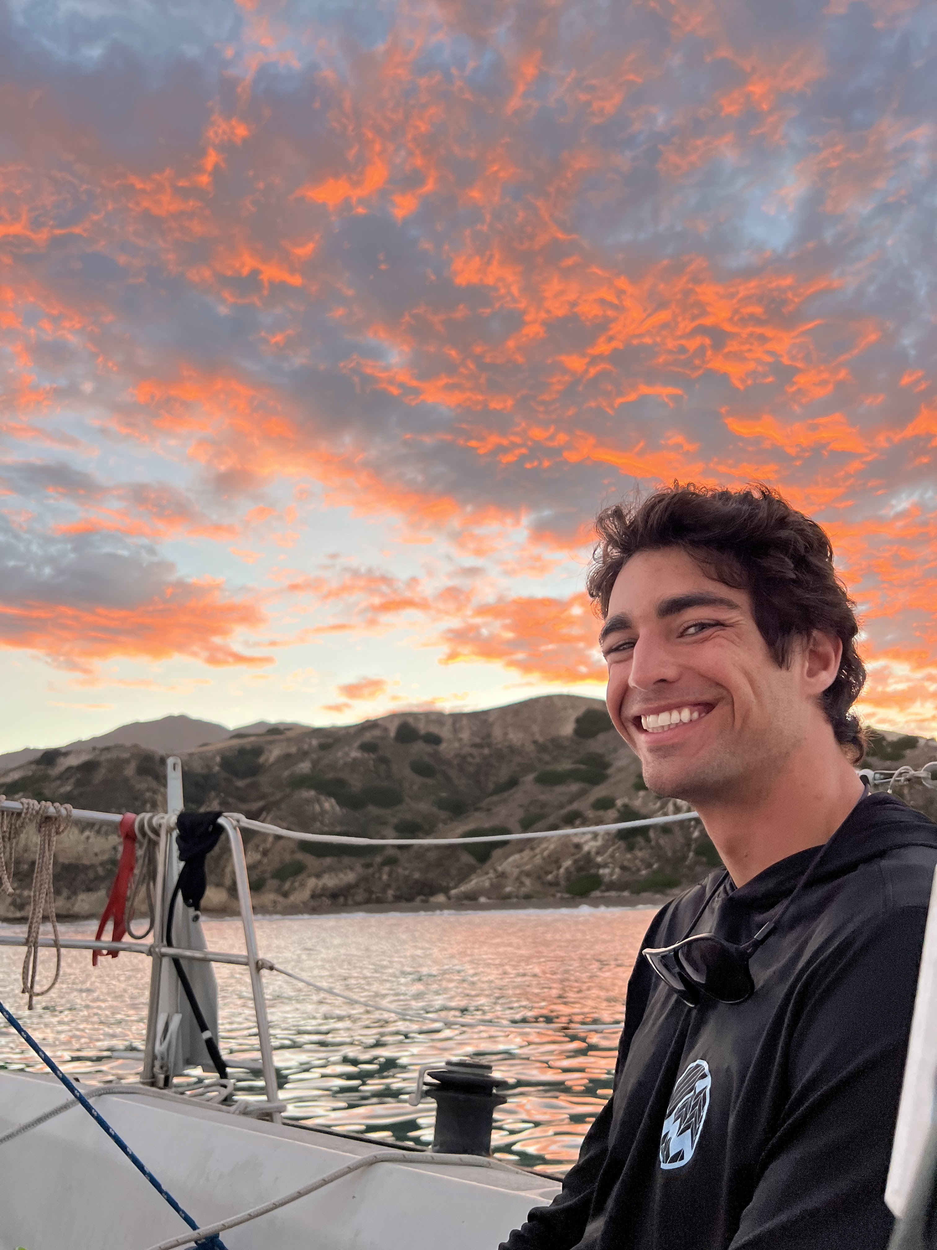
On Wednesday morning we headed out. We took on diesel, which gave us a chance to do a practice docking, too, and then left the harbor under single reef. We rigged jacklines, and within a few miles decided to tuck a second reef, to keep things sedate. Darian got some practice driving, and we took turns as things got blusterier and choppier near the islands. The boat was fast under second reef, but I the leech of the main was very flappy -- very bad for longevity of the sail -- and the boat's wave piercing power definitely felt diminished in those conditions, probably 17 kts or so of breeze. I am also concerned that if I were to carry that second reef for, say, a week, the chafe at various spots would wreak absolute destruction on the sail. Nevertheless, it was a fast passage, and we were anchored in Yellowbanks, with two other boats, by 4pm. The skies were tropical and we were treated to an epic sunset. 
The next day, Thursday, was one of those days that make Yellowbanks really special. The sky was clear blue, the breezes light, and there was a small south swell running that had all the surfers stopping by in their Radons. Darian made a SUP trip to the Yellowbanks beach to explore, then surfed the break (on the SUP, no less) and caught some beautiful long rides, and visited Smuggler's in the evening. I SUPed on the inflatable and did a bunch of fishing and lounging. I had some luck with jack mackerel and jacksmelt, but sadly didn't get lucky enough for dinner. Smuggler's was oddly sparse, and the crowd at Yellowbanks turned over but remained at a steady two other boats besides ours. The sunset was less spectacular, but the moon and stars stole the show. 


I didn't sleep once again at anchor, in particular because around 4am the wind did a 180 from the direction we'd set the anchor in, and strengthened. If we'd dragged, we would have ended right on top of a catamaran that was anchored nearby. However, the anchor held just fine (in 25 ft depth with ~150 ft of rode). The Friday early morning weather check gave a building zone forecast, and I knew it would be stronger the further west we went, so, although I'd wanted to head for SB next, I decided we should return to Oxnard. The day was completely socked in, and, once we got inshore of the Anacapa passage, the wind shut off as well. We ended up motoring most of the way back. We used the pumpout -- more practice docking -- and returned to the slip. We celebrated with guacamole, cleaned up the boat, had amazing Pho for dinner, and I slept for 11 hours that night. 
Saturday was also completely socked in, so we decided to head to Piedra Blanca and the Sespe Creek to get some sun and see something different. The 33 has recently reopened, but still has several sections of one-lane traffic, controlled by lights. Despite the hot conditions, there were a dozen cars at the trailhead. We hiked up to the first piedras, so Darian could see what those were like, and I was barely handling going uphill in 91 F. Then we backtracked and walked along the Sespe, looking for a spot I thought I remembered, where the creek used to run through smooth rocks that made for good pools, which used to hold trout even through the early years of the drought. But it seems that during the last few wet years the creek has shifted out of the bed I remembered and into one further south, or perhaps the bed I remembered has been remodeled by a lot of new material transported downstream. We quit looking around the 2.2 mile mark and headed off trail to find a spot to dip in the creek. We displaced a family of ducks from their spot and enjoyed a good cooling down and nibbling from the minnows. We then decided to return by walking in the creek bed, instead of via the trail. We did eventually get blocked, at a spot near the trail crossing where the vegetation gets too thick along the active creek bed -- the old creek bed is still passable, but you have to get through the very rugged spot where the two join up, which has lots of downed trees and a general mess. We both got small foot injuries during this return trek, Darian being barefoot for it, and me wearing Chacos, but it was still worth it. We returned to the boat via Ventura, for a pilgrimage stop at Patagonia HQ, Real Cheap sports, and a stop for Himalayan momos, preceded by tacos from the pastor stand just outside. Too much chai during dinner kept me up all night, idiot that I am, so I am still recovering from the sleep deprivation. 


Sunday, May 26, 2024

Neanderthal Wall attempt #2

 This time we attempted to reach Neanderthal Wall from Pine Flat (a few years ago we'd tried from the east). We almost got there, and now we have beta for the very faint trail that takes you 95% of the way there. We just need to puzzle out the final bit, but honestly, the final bit looks to be the worst part. 
The Pine Flat campsite was pretty great though, and it had water, at least in May. The Subie ran its battery dry, and we had to hike out to find a ranger to give us a jump, so I've added a jumper pack to our gear. We'll be back.


Tuesday, December 28, 2021

Lamont Pinnacles and Bald Eagle Peak

We were feeling ambitious on a long late fall weekend and managed to visit two places I'd been wanting to check out for a while.

The first was the Lamont Pinnacles, which I had been jonesing to visit since camping near Chimney Peak Recreational Area earlier in the year. 

(Interlude: On that early Spring 2021 trip I'd gone out to Long Valley, hiked along the creek to a point just short of where it joins the South Fork of the Kern, and dealt with both ice and many many ticks on the trail. I camped overnight in my still-new-feeling Subaru and ate beans that I reheated in a small cast iron cook pot that I was testing for the first time. It was a mid-pandemic trip that really helped me reset and blow off some steam.)

The Lamont Pinnacles trail was relatively easy to follow, but steep. It was exactly what we needed to feel like we'd accomplished something. We turned around just short of the gully that separates the mountain you're doing most of the hike on from the Pinnacles proper. One of the fun aspects of the hike was that the destination isn't visible from most of it, so it is a real reward when it appears. However, throughout the hike, the views of Canebrake and the valley further are absolutely spectacular.

PXL_20211112_230028278

The next destination we managed to hit was Bald Eagle Peak off Saddle Springs Road. I've been wanting to head up there for a while now, but my previous car wasn't up to the task. The Subaru did great, and I even had a chance to play with X-Mode on the descent, which was fantastic. There's lots of sharp rocks on that road, so I was pretty worried about my stock tires, but didn't actually have any issues. Eagle Peak has a bunch of sport climbing routes on it, so this was technically a climb scouting trip. The trail was pretty easy to follow, though we went out on top of the ridge and returned on a trail on the back of the ridge. We don't know which one is technically the correct one -- we suspect the one on the back. We don't have beta for the routes and they look *hard*, plus the notion of climbing there is complicated by access considerations: the road is closed during wet season, but the location faces South and is probably sweltering during the drier months of the year. Regardless, it's a gorgeous chunk of rock and highly motivating. We'll keep digging for beta.

PXL_20211113_211740332

Monday, August 6, 2018

TR: early August sail to Santa Cruz Island

I'm going to move blogging about Mental Physics, my Olson 25, here, since I don't feel like it's worth a separate blog. There's some backstory about the boat that I might fill in, when I get the chance, for instructional purposes. In the meantime...

Ben and I made it out to Santa Cruz Island from SB for the first time on Mental. (We'd done one trip to Yellowbanks and one to Scorpion last year from CIH.) We took off around 10am on Saturday. The wind filled in for real around 1pm, and we reached SC near Lady's and sailed down the coast (reef + #2) in big swells, poked into Fry's where we found three sailboats anchored, but kept going East because the forecast for the next day was for high winds and I didn't want to deal with it on the way back on Sunday. We found E Twin Harbor empty and dropped anchor in the middle, with a stern rode to the beach at high tide. Overnight there were periods that were comfortable, and a few hours when swells reflected off the SW corner of the cove and made the motion of the boat pretty uncomfortable.


When I was coming back from swimming the stern rode ashore, I surprised four bat rays who took off right and left. The other critters in the cove were spotted (presumably harbor) seals, who swam from kelp bunch to kelp bunch and popped out up to their chests whenever we did something interesting, like put in the kayak. I also saw a dark brown bird with a bright red beak that I'd never seen before, which I think was a black Oystercatcher. Sea surface temp was 73 F on Saturday evening and 71 F on Saturday morning, in other words: balmy.

We left Sunday at 11am, thinking the wind was filling in, but didn't get consistent wind until about noon. We saw a mola mola in the SB traffic lane, and two enormous container ships in the NB lane. The wind shut off 5 nm from SB, and I caught nothing trolling greenie. We were back at the slip by 4:30pm. 

Monday, April 13, 2015

One more Red Rock

Jason and I were at Red Rocks this past weekend. On Saturday we started by doing a mish-mash of a trad route: Jason led most of the first pitch of Splitting Hares to the first belay of Too Many Tantrums. I then led the second pitch and most of the third pitch of Too Many Tantrums, back to the roof and traverse of Splitting Hares. Got lost a bit above the roof, downclimbed and traversed. Super fun!

Then we moved to my old friend, Pauligk Pillar. There I had to over-protect the first few moves, resulting in a mid-route belay stop, and Jason led the second portion of the pitch. We weren't feeling the second pitch, AGAIN, so we hiked out to make the 8pm exit time.

On Sunday we played on Panty Wall, then went down to the Hamlet, got schooled on one of the lower tier sport routes, did an upper tier 7, and tried for a lower tier toprope, which proved uninspiring. Overall a good day to stretch out the soreness!

Monday, January 5, 2015

A paragraph about suffering

I enjoyed this article in Outside magazine about Misogi. This paragraph about what my older mountaineering friends call "suffering" struck me as particularly accurate:

But something funny happens once you’ve been in the grip of a painful ordeal for a certain amount of time. Namely, the body and mind—inured to the unwelcome task they’ve been set upon—mostly stop fighting it. Resisting takes too much energy. It cannot be sustained. And, gradually, in place of my instinctive resistance came an active kind of relaxation and acceptance.
This definitely happens to me when backpacking or approaching climbs in the mountains. Invariably I'm in pain of some kind -- my knees, my shoulders from the pack, altitude, it's always something -- and I just grind on and on. It's slightly different from paddling, which puts me in a distinct zone I call "machine" mode, where I'm lustily pounding at some physically exerting thing for hours with my brain finally shut up.

Monday, October 27, 2014

Climbing recap for most of 2014

Wow, I look back and realize I owe more than a year's worth of climbing updates. Yikes!

So, last summer and fall I remember doing the following:  
  • climbing Summer Sojourn with Anil, me getting really bad nausea from wearing new, distorting sunglasses, and him getting a food allergy after we got down, but not before encountering a massive rattlesnake on the descent trail!
  • training to increase my knees' endurance and my altitude tolerance on the Cathedral lakes trail, 
  • climbing on Dozier Dome (was it Holdless Horror?) with Josh, 

  • making another attempt on BCS with Josh and Terri,
  • climbing (and getting hailed on!) at Clark Canyon with Theresa.


Then I started a new job right after BCS, and late fall 2013 and winter is a blur.

In spring Theresa and I started training a bit more in earnest, and went out to New Jack City a few times.

In early summer we made a trip to Dome Rock and I took Theresa up her first trad multi-pitch, Tree Route. We also did Permanent Income Hypothesis a couple times, with T. leading, and all the time I was training in the gym with Jason and Anil.


Jason, Theresa and I teamed up for a Tuolumne weekend in which I led West Country on Stately Pleasure Dome, and then we practiced crack climbing at guide cracks the next day.

And in October Theresa and I went to Red Rocks where we played on the Panty Wall the first day, T. led Big Bad Wolf on day 2, and I led the first pitch of Ragged Edges on day 3. We were having too much fun to take pics :)

So, it's been a slow year, mostly due to the new job and due to the project of moving Koan up to the Bay Area taking up so many weekends, but not altogether a bad year!

Friday, March 8, 2013

Fall & Winter recap

Dima on the approach to Purblind

Lest the reader (hi, all 3 of you!) think that there has been no climbing this past fall and winter, I would like to submit that I did do two trips. One was to Red Rocks in early November with Dima, then hooking up with the Minnesota crew, and the second was to JTree with part of the aforementioned MN crew.

In Red Rocks we climbed Purblind Pillar on Angel Food wall. It was great, but the whole time I was thinking how we should have been doing Tunnel Vision, because that looked amazing. Stilgar's Wild Ride and Group Therapy also looked awesome, so they are definitely on my tick list. The descent was quite Olympus-like, though. Definitely plan some extra time for that. On the second day I screwed up our approach beta and we overshot the area where we were supposed to meet the MN crew (wherever Great Red Book is, which is now also on my tick list). So after a bunch of wandering around and figuring it out, we decided to head to Ice Box canyon to investigate, since it seemed like a reasonably warm day. We got on Shady Ladies (meh) and Cold September Corner (insane!), and it *was* really cold in the shade. The trip was topped off by a huge thing puncturing my brand new Yoko tires, which irked me to no end. But thankfully by Monday morning I was able to find a place that could patch it, for free, to boot, and head on home.

The second trip to JTree was a bit impromptu, when I found out that my peeps from MN were heading out there for a weekend. We did the Eye, Stichter Quits, whatever the route with the one bolt is a bit to the left of that, and top-roped Battle of the Bulge. And had glorious glorious Indian food, which was at least as good as the routes.

So, in spite of two long international trips, getting sick three times, and shit-tons of work, I did manage to get out twice. Score!

Wednesday, January 16, 2013

False positives suck

I've been holding out on writing about my recent sailing trip from the Galapagos to Panama City, because during the trip there was an occurrence that seriously rattled me, disturbed my crew-mates and generally marred a trip that had begun and promised to continue in a very chilled out atmosphere. I was dealing with the aftermath of that event until just now, when I got off the phone. Not wanting to tell an incomplete story, I suppose that now that that aftermath has concluded, I can go ahead.

On the second day of our passage my SPOT satellite messenger malfunctioned. I am frankly exhausted hearing about, re-telling, writing down and trying to intellectually and emotionally process what ensued, so I cannot bring myself to put it all down in detail one more time here. I'm sorry. I'm sure if I were a good journalist, it would spin an excellent yarn. And there are obviously a number of very very serious implications, so maybe we can talk about those in the comments, or on twitter, or something -- I'm pretty sure I know all of the 4 people who follow this blog personally -- because it's the implications that matter.

I had been using the SPOT the way I usually do, pressing OK once a day, to let my partner (via text & email) and my parents (via the website) know that all was well. I've used the SPOT this way for about 14 months, maybe 3-4 trips. Well, on New Year's Day, instead of transmitting an OK, the SPOT freaked out and started transmitting a spurious stream of "Help" and occasional "Cancelled" messages. Take a second to think about that. Deep breath. Continue. 25 minutes later, unaware that anything was amiss, I tried to turn off the device, as I always do, to save the batteries. It wouldn't turn off, so I thought, "wtf?", popped off the back and took out the batteries. That did it. That's when the random stream of "Help" messages stopped.

Several hours later, via a call from US Coast Guard to the boat's sat-phone -- which was not configured to take incoming phone calls, thereby blowing the skipper's mind -- we found out that my partner, my parents, the US, Ecuadorean and Greek Coast Guards and my private medevac insurance provider, Global Rescue, had all spent the previous few hours trying to ascertain my well being, looping in a half dozen additional minor players in the process. Had the USCG not magically been able to raise us on a sat-phone (one that has never in the past had and never in the future will have another incoming call -- magic!) the next step that was being proposed was to scramble a C130 spotter plane. Once the USCG reached us, the situation was put to sleep quickly and in an orderly fashion.

So, some distilled thoughts:

1) My partner and I have a protocol that we discuss in advance of each trip for how to respond to each of the possible SPOT messages (OK, Help, SOS and "custom", which we use as "cancel the protocol"). The protocol is basically the same in most use-cases (sailing on my boat, sailing on other boats and climbing), with small changes for what agencies to loop in. The protocol we had in place worked perfectly, so in hindsight we can look at this as a fire drill. Our agreed "Help" response is to wait two hours for an OK (thereby canceling the "Help") or an SOS (thereby immediately escalating it). That is, "Help" is what I'm supposed to push when there's something going wrong, and I am worried that I will not have a chance to press SOS later, but I'm working the situation at the moment, so there is no immediate need for assistance. E.g. the boat is heading for the rocks, but I'm trying to get an anchor down; or I've gone overboard, but I'm tethered and trying to get back on; or my partner's slid down a couloir, and I'm glissading down to check them out myself. If everything works out, I will press OK later. If things go to hell, I will press SOS. If I don't press either, two hours after the Help, my partner will assume that things have not gone well and that help is needed, and escalate to the SOS protocol. Even though in this case the "Help" message was sent as a result of hardware malfunction, there was no way my partner could have known, and there was nothing that he could or should have done differently. Our escalation strategy (first confirm the message with SPOT, then start looping in agencies and Global Rescue one by one, and follow their instructions) was correct. I would highly recommend that anyone who seriously uses SPOT plan their protocol in advance, together with the people who will have to enact it.

1b) I did learned something from a mistake I made. The moral: consider not having Help and SOS messages appear in your public mapping page. I normally don't have them appear, but I stupidly enabled them just for this trip, for no reason at all. The only person familiar with the abovementioned protocol was my partner, who was receiving messages directly, but my parents were also following along on the mapping page. Ideally, in case of Help and SOS, my partner should have been the only one to act. But through a time-zone vagary, my parents happened to look at the mapping page right after the spurious Help messages began. Thankfully, they contacted my partner first and he was able to more or less restrain them from taking actions outside the protocol. Mostly. The looping in of Greek Coast Guard was of their doing. In the end it proved invaluable in getting in touch with the UK Boat Registration Authority, through whom the sat-phone number was located and passed to US Coast Guard. But that's neither here nor there. I suppose my point is: choose whether you want just your protocol people, or the whole world to know about your Help and SOS messages, and set up your mapping page accordingly.

2) The agencies that my partner and parents contacted (US, Greek and Ecuadorean Coast Guard, Global Rescue) treated the SPOT "Help" message as credible. Nobody at any point suggested that the device had a track record of false positives or was unreliable in the least. That, at least, is heartening.

3) These agencies are AMAZING. They are total pros. They apparently did an incredible job sorting it all out, and interfacing with each other, and they were completely unfazed (the same cannot be said of some of the private parties involved) when it turned out to have been a malfunction. Treat these first responders with courtesy and respect, and they will save your hide. As first world citizens, we are so fortunate to have them available to back us up.

4) In the end, while the OK-mode for the SPOT is convenient and nice to have, I WILL NEVER USE IT AGAIN. I can understand how a device might fail to work, that is, how it can fail OFF. But I now know that an un-abused, un-wetted, comfortable SPOT can, for no apparent reason at all, fail ON. I cannot possibly take the chance that, while I'm just trying to say "Hi, I'm here, I'm OK", it will accidentally report me as being in distress, distressing all my people, in turn, and potentially launching a rescue. Screw the convenience and novelty of saying "I'm OK". The bottom line: I cannot do without SOS. I can do without OK. But then why own a SPOT instead of, say, a Personal Locator Beacon of some kind? But also, is the implication that people must personally experience a false positive before they realize that the risks associated with OK-mode are not worth it? And are false positives like this not bound to erode first responder confidence, in the long run? The answer to these questions depends on the specifics of the statistical distribution of false positives -- i.e. are they rare events, or are they significant (my data point: ~1/40 OKs turned into a false stream of Helps; that is *horrible*, statistically)? I hope, for the sake of those of us who may have to use a SPOT in a real emergency some day, that SPOT is doing its homework.

The final chapter in all this is SPOT's response. I wrote them a report of the incident, and said I wanted two things: a) for them to investigate the incident and learn something from it, and b) a replacement device, even though mine was 2 months out of warranty, and even though I vowed never to press OK again. Two days later a customer service agent called me who was obviously completely unaware of the implications of my story. She suggested that I pay $50 for a replacement device and initially had no comment on my sending it in for an investigation. I said that they could either send me a new device for free or cancel my account. She acquiesced and promised they would be sending me a warranty RMA email, with an address to which to mail the faulty device, and would be sending new a device. I pressed her on what kind of investigation they would conduct on the old device, but didn't get anything other than an assurance that they, in fact, would conduct one.

I think a chunk of the serenity prayer is relevant here...

Serene sunset, near the equator.

Wednesday, November 28, 2012

Pregnant ... with project

At the canyon by slampoud
At the canyon, a photo by slampoud on Flickr.
“When you are inspired by some great purpose, some extraordinary project, all your thoughts break their bonds; Your mind transcends limitations, your consciousness expands in every direction, and you find yourself in a new, great and wonderful world. Dormant forces, faculties and talents become alive, and you discover yourself to be greater person by far than you ever dreamed yourself to be. “
– Patanjali (borrowed from Mayan Smith Gobat's blog)

So heart-full, and so much to catch up on, and how to put it in words?

A bit over a year ago a clock started ticking. I think of it as somewhat equivalent to some women's "biological clock": insistent, persistent, looming large. In my case the yearning was, simply, for a place of my own. And not just to own it, but to *own* it, to know every molecule, preferably to have been responsible for the location of most of the molecules! I am very fortunate to have a beautiful rented roof over my head, and my dream sailboat as my woman-cave. But I gluttonously craved a bit of outside, a dry spot under a big rock, a gazebo, a dilapidated cabin, a big hearty tree, *someplace* on dry land to call my own.

After about a year of searching, waiting, and hand-wringing, I finally took the leap. That's the spot in the photo. I knew it was the place the minute -- near sundown, in late winter -- I stepped out of the car and inhaled the view. My citicard's unreasonably high credit limit, and post-holiday 0% financing ("to pay for Christmas indiscretions") did the rest.

So this is my new obsession: a bit of dirt, and what to do with it. I've decided to build a "cabin" (a shed, really), and I've spent the last three weeks or so obsessing full time (though I've been obsessing part time since I bought the land).

So I know this blog is usually about climbing, but I think building a shed (close to one of the world's best climbing locations, the Needles, to boot) is also well within the "little did I know..." class of things for me. So in the next few days I'll be sharing some thoughts about how I picked the location (e.g. climbing considerations!), how I've been going about getting from 0 to 60 on the subject of sheds and building (with links), and other stuff along this vein.

And before I forget, an attribution for the quote: I was reading Mayan Smith Gobat's blog this morning, and she had this (and another quote by Leo Buscaglia, a favorite of mine!) on her "philosophy" page. It suits me very much at the moment!

Monday, July 9, 2012

Sherman Peak

Huckles on Sherman Peak by slampoud
Huckles on Sherman Peak, a photo by slampoud on Flickr.
This past weekend my goal was to spend some time hiking with my pooch, and to do it at altitude, so as to acclimate for an upcoming (I hope) high altitude ascent project a friend and I have in the works (wink wink!). Indeed Hucks and I made it up Sherman Peak, which is 9909 ft tall, via the 5 mile r.t., ~1000 ft elevation gain trail from Sherman Pass Rd. The trailhead was full of mountain bikers, so for a moment I was terrified it would be a very unpleasant experience, but they went downhill and we headed uphill and it all worked out! A big question in my mind was whether dogs feel altitude the same way humans do, and I think the answer is: yes. Huckles slowed down considerably as we progressed on the trail. I was huffing and puffing very badly myself. So now I have to think about acclimating the dog as well as myself for any future shenanigans.

Tuesday, June 12, 2012

Dome Rock & Kernville Slab

This past weekend my friend Jason, who now lives in the Bay area, and I were planning to spend some time plugging in gear. The original plan was to spend a day running up and down Tree Route on Dome Rock, then go down to Voodoo Dome and do Summer Sojourn, then further down to Kern Slab.

We met on Friday night at Quaking Aspen campground, which I'd always bypassed in years before. It turns out that campground is absolutely beautiful, and a great meeting spot if someone in the party has never been up in the Needles area before, and is arriving in the middle of the night.

The next morning we headed out to Dome Rock. I first led Tree Route, which is really as much fun as you can have at the 5.6 grade. We dilly dallied a bit on top, and then headed back down so that Jason could lead it, for his first trad lead. Unfortunately there was a slow party up ahead, who'd gotten some gear stuck at the first belay and were refusing to let it go, so we couldn't leave the ground. Eventually I yelled up at them that we'd bring their gear to them, if only they'd get going and let us climb! While hanging out at the base we met another party who started up right behind us and did Anti-Jello crack to our left, as Jason led Tree Route. He had no problems with the leading, except that the slab on the last pitch turned him off, so I finished that one.

We left for the low road around 4, I think, but when we got to about 5 miles before Needlerock creek, there was a sign on the road and a ranger in a truck, saying the road was closed due to a fire a few miles down. They could at least have put up a sign at Johnsondale, so we didn't have to drive the 15 windy miles to the road block!

At that point my mind was fried for dealing with logistics, so we headed down to my favorite brewing company in Kernville, for burgers, beer and internet access. We threw around a bunch of ideas -- Crystal Crag, Cathedral Peak -- but coming on the heels of driving to San Diego and back in a day, and the detour of Friday night (I-5 was closed), I was not really up for much more driving. We decided to bivy under Kern slab, and revisit the issue in the morning.

In the morning, since the slab was right there, and in shade, to boot, we decided to head up. I led the Lieback, which I'd followed twice before, but never led, with one take to rest up and make sure I don't blow the crux. It was one of the coolest leads I've done, even if, technically, it's the lowest rated one. That is the most ridiculous sandbag in the world! At the top of the Lieback we went right, and Jason led a little hand traverse + chimney to the anchors for Claustrophobia. Then we rapped down the slab. Then he led the 5.7 pillar section of the Chouinard Special, and we played a bit on the knife-thin crack below that anchor. Eventually it got really hot and we headed down to the river, stopped for Mexican food at K-ville and called it a trip, leaving a day early. My calves were killing me after 12 pitches! But, hey, this was an off-the-couch trip for both of us, and I'd call it a very successful one!

Monday, February 13, 2012

Kern Slabs

On the Kern Slabs by slampoud
On the Kern Slabs, a photo by slampoud on Flickr.

This weekend Dima and I stopped for some wine tasting (at Blair Fox and Sanford) on the way to the Kern Slabs. On Saturday we climbed the first pitches of the Lieback and the Chouinard Special, and TRed the Thin Cracks and Initiation Crack (which I still can't even start!). On Sunday we climbed Claustrophobia and TRed Dirty Dishes. Lieback and Claustrophobia have to be two of my favorite climbs ever!

Tuesday, February 7, 2012

JTree

This season has been a JTree season, beginning with the 3rd annual #jtreetweetup, continuing with a pre-Christmas trip and, most recently, with last weekend.

The #jtreetweetup was, as always, wonderful. I drove with Chad and his little daughter, and we met up with a few of the old crew and many new folks, at Ryan Campground. We got rained on all Saturday, so we spent it working out the approach beta for Mental Physics, which was fun. Sunday was glorious, and I finally got to follow the two face climbs on the Headstone.

The pre-Christmas trip to JTree was marred by food poisoning, that I brought with me from SB. I spent a couple days sick as a dog, a day belaying only, and on the last day Dima and I went out to Mental Physics, where he led that, and we top-roped Dazed and Confused, to its left. Both were fantastic routes!

Finally this past weekend Dima and I drove out, stayed in Ryan and he led Light Sabre (in the Geology Tour area) and Double-Cross on Saturday. On Sunday we played on Big Bob's Big Wedge (as you can see from the video) and then climbed Tranquility, on the Moosedog Tower in Indian Cove. All in all, a great weekend!

Tuesday, October 4, 2011

We went, we saw, we didn't climb

Ben and I decided we wanted to attempt Bear Creek Spire. We both have the High Sierra Climbing supertopo, and we both looked at it and decided that we liked the idea of a destination that had two alternatives from which to choose: the 5.8 North Arete, and the low 5th class Northeast Ridge.

We had been planning to go about a month ago, but ended up going to Courtright Reservoir instead, because we couldn't get permits for overnight stay at the Little Lakes trailhead. Last week looked like the last opportunity of unequivocally good weather in the Sierras (this week the storms begin), so we headed out there mid-week to attempt our objective.

For me this trip came a week after spending a week at Banff National Park, so I was still somewhat acclimated to higher elevations. Ben was coming straight from sea level. I was essentially taking a long weekend in the middle of the week, so we had to do the whole trip in three days, including the getting there and back.

We took off Tuesday morning and got to the Little Lakes trailhead, overnight permit in hand, around 4pm. Backpacking up to Gem Lakes took a couple hours, so when we got there we decided to stop, make dinner while we still had some daylight left, and overnight there. Gem Lakes Valley is possibly the most beautiful place I've ever been, and, on top of that, the trail to continue up to Dade Lake was not obvious, so I had no objections to staying, though my legs were definitely good to go for a while longer.

The next morning we got a leisurely start, based solely on the time it took for the sun to peek over Morgan Mt. to our east, and hit our campsite. We were off and searching for a trail to Dade Lake by 9am, loaded only with climbing gear, and planning to hit the easier Ridge, instead of the arete.

It turns out that there really is no "trail" as such. We learned from the book that we should look for a steep talus slope, of which there is exactly one, so there was little ambiguity there. But nothing we had read prepared us for 2.5 hours of steep, unmarked talus to Dade Lake. Having previously had near-injuries while slogging in talus, I consider it the worst possible terrain to be in during the last part of a tired descent. I was completely demoralized by how long and hard the upward talus slog had been, by the fact that we'd have to do it again, in reverse, and super tired, possibly in the dark, at the end of our day, and, finally, by the fact that there was no way we would ever have managed this talus ascent with full backpacks the night before. It felt like we had done something definitely wrong, but we were definitely following directions right.

By the time we got to Dade Lake I was pretty sure I wasn't up for the rest of the day as we had planned it. We would next have to traverse a snow field, then more talus for over another hour, before reaching the base of the climb. Then we'd climb for 5 or so hours, then we'd have to descend by glissading down a snow gully, and slog talus for 3 more hours to get back. Given our 11:30am arrival at Dade Lake, we were looking at finishing our glissade, with three more hours to go, around nightfall.

Throughout all our preparations it had not occurred to me that what we were planning was actually a mountaineering, and not a climbing trip. The guidebook and websites we'd consulted made it sound like on some trips, some times of year, some people chose to bring snow gear (ice axes and crampons). We were in what I would consider the absolute end of the local summer and, in my non-expert opinion, snow gear was necessary. I was completely uncomfortable with the idea of crossing that snow field without traction, and of glissading down the gully without an ice axe. Couple that with the late start and lack of relevant fitness (i.e. lack of ability to go on autopilot on talus at 11,500 ft for 6 hours, and have faith that I'm not going to miss a step and land on my face, or overturn a boulder and end up with a crushed ankle, both of which I've *almost* done in the past), there was no choice, for me, at least, but to bail on the plan.

I don't know what Ben's process was, but I was pretty annoyed that I had to deal with his long and silent inner struggle. It was completely clear to me -- and it did not diminish me or my self esteem at all! -- that we had bitten off more than we could chew, and had underestimated this project.

Given that the talus ascent had been so miserable, and that we thought we couldn't do it with full backpacks, if we ever chose to return, it was time to make lemonade, and try to find a better way down (or up, for the future). We descended into Treasure Lakes Valley, then down towards Long Lake following the fishermen's path. This trail is actually mentioned in the supertopo, but not recommended, because it is supposedly longer and has more talus (!!!). It took us the same amount of time, so if it's longer it's only marginally so, and I thought it was slightly more pleasant, as far as talus goes. We paid close attention to the maps and terrain, and we think that we've found a way to get from Gem Lakes to Dade Lake by traveling cross country, following the ridge immediately East of Treasure Lakes. Since, next time around, we will be seeking to minimize our distance from Bear Creek Spire, in order to shorten the climbing day and avoid talus travel at the end of it, it will be important to get all the way to Dade Lake. So this ridge is the only option we think we can handle, with full backpacks...

IMG_0100

We spent the rest of our day lolling about Gem Lakes, took a quick swim, made movies of trout (I call it "fishing"), and acclimating (for no reason at all). It was a beautiful and restful day, and I was really glad to be there and not epic'ing up at Bear Creek Spire. The backpack down the next day was equally beautiful. A couple days later I read of a rescue in the Tetons (apparently the third this year) of a guy who glissaded without an ice axe and ended up with broken limbs when he lost control. That made me feel a lot better about my admittedly inexpert assessment. I climb for fun, so the idea is to do it only to the extent that I can live to continue doing it uninjured.

Wednesday, July 13, 2011

This year's Needles expedition -- day 2, attack of the carabiner

Saturday morning found us sleeping in, so we decided to forgo the hike in to the Needles and opt for the lower elevation and shorter approach of Dome Rock, on which we had an objective, the Anti-jello crack.

The carabiner made love to meAnti-jello crack starts with the easy first pitch of the Tree Route. The second pitch is a 5.9+ fingers-to-tips crack, which I suspect was tips-to-nothing for Dima. He led almost all the way up it, and when the feet ran out, the crack thinned to almost nothing, and the protection got really tricky he had to hang and aid through the last bit of it. It only takes a sentence to say and justify that, but the process of making the decision and carrying it out is actually quite emotionally wrenching and time-consuming. I tried to be a good partner and give him all the time and support I could, but I never quite know whether to speak up or shut up. In any case, I was in the shade of a tree and quite comfortable. Dima finished that pitch via a right-trending variation that took us back to the Tree Route.

As for me, I think that pitch was possibly one of the best pitches I've ever climbed. The size was very suited to me. I had to stop and hang twice while cleaning nuts that were really stuck, as well as liberating a booty nut that someone had clearly used to bail on the route. Another bailing nut was fused and stayed in. During the second "take" to clean a nut I had a little accident. The draw on the piece above the one I was cleaning got jerked violently in the take, the biner at the end whipping around and fluttering and eventually taking a nice big bite out of my left bicep. It took a good chunk of flesh out, and made a giant bruise around it. It hurt a lot, but I was in the moment and didn't pay much attention. Later, at the top of the route I stopped to disinfect and bandage it.

The mountain made love to himAt the top of the second pitch we switched to me leading up to the anchors of the last pitch of Tree Route, since I had the whole entire giant rack of tiny gear on me. It was fun to be, however briefly, on the sharp end. I think Dima either doesn't trust me, or is so concerned about me getting hurt and screwing up his climbing plans, that he almost never lets me lead. He certainly never asks if I want to. The silent arrangement suits me, however, as he is a lot more willing to get on harder things and flail than I am, as a leader.


The last pitch of Tree Route -- in fact the whole route -- is super fun. It's a lowish angle slab, with a single bolt in the middle, a bit like the last pitch of Angel's Fright/Fingertrip on Tahquitz, but easier. Above that are just slabs to the top. We hung out on the slabs, licking our wounded egos and arms and enjoying the incredible view. A lovely breeze had kicked up, really helping in the 80s temps and full-on sun. Eventually we walked off the rock, I took a nap, and Dima went back to the base to retrieve his gear. We finished our day with another visit to the Ponderosa, where the service sucked and the food made us both quite ill. But more about that on the next day's log...

Tuesday, July 12, 2011

This year's Needles expedition -- day 1

Reentry from this year's expedition to the Needles, with my friend Dima from Texas, has been the hardest yet!

At the campsite
We took off midday on Thursday, arriving at Kernville in time for some lunner and a beer at the Kern River Brewing Co, as is our custom. We made it to the Needles campsite before dark, which was just as well, since the dirt road had a couple major mudholes that we had to negotiate, so sunlight was definitely a plus. The campsite was quite full, and we snagged the last available official camping spot, as far away from the folks with the television in their Sportsmobile as possible. I slept in my car, as usual. Dima pitched his Nemo tent, which is extremely entertaining to watch. A single PhD does not qualify one to pitch a Nemo tent, no siree!

On Friday we racked up, and steeled ourselves for the long approach. We got to the notch by the Witch only to find several parties already there and racking up, and a party already on the route we wanted to do, Airy Interlude. A little taken aback, and psychologically unprepared to deal with people, we decided to head for another objective of ours, a route named Spooky on the Charlatan formation. Spooky can  be approached either from its base, by dropping down the notch between the Charlatan and the Djin, or by rapping the route from above. Initially we had a hard time locating the notch, and then we were put off by the allegedly 4th class chimney at the notch. Our beta said to expect rap slings at the top, but we found none, and we were not about to downclimb it, though we did see other parties who did later on in the day. (In the evening we spoke with Kris Solem, who is writing the new Needles guidebook, and he confirmed that indeed there are no rap slings, and that the chimney has gotten worse in the last couple of years since a flake broke off and a lot of soil eroded from the base making it deeper.) We set out to get to the top of the Charlatan to find the rap rings for Spooky, and finally succeeded after some time and a whole lot of scrambling. The top of that formation has to be one of the most spectacular spots on earth. There is a feeling of a whole lot of air around you that's absolutely breathtaking and incredibly intimidating at first. You do get used to it eventually, but initially it takes a real effort to walk around.

Me at the base of the second pitch of Spooky. Check out the crazy rock face!
The Charlatan is topped by a rock much like the headstone in J-Tree, but a little smaller, which has a crack on one side called the Lady of the Needles. This is rated 5.7, so we figured it would be a good warmup for the harder Spooky. It was indeed a very fun route, packing at least a couple interesting moves in no more than 40 feet of climbing. The top is very narrow, requiring the climber to either hang from the anchor or straddle it, which I thought was a hoot. The view is amazing!


The forecast had given us 15% chance of rain, and as we warmed up we watched the thunderheads slowly accumulate around us. None were too low or too close, though, so we decided to attempt Spooky. We were a little worried about the possibility of the weather getting worse in a rush, so we fixed our second line so we could bail very fast, if the need arose. We rapped the route, and started up. Dima led both pitches. The first, which goes at 5.8, was a solid hands crack for me, ending with a lieback section. It was a half a rope length long and I was loving every second of it! The second pitch, rated 5.9, starts with a 15 foot off-width, then continues up a sculpted face that looks probably like nothing you've ever climbed. Solidified waves is the closest description I can come up with. I could see that Dima was feeling rushed, and despite the fact that I had my eye on the weather and had persistently tried to take his mind off it, he wasn't paying attention to me. The off-width gave him trouble, and the demoralization from that made him uncertain in the face section of the climb. He finished the climb, but it was pretty clear that he hadn't especially enjoyed it. I couldn't figure out how to get into the off-width, so I started it as a lieback. That worked remarkably well until I got to the #4 camalot that Dima had walked up with him, about halfway up. I couldn't get that out while liebacking, so I tried to transition into the off-width, took a fall, and then thrutched around like a fish out of water for the rest of the off-width. At no point did I manage to regain any control or poise. Use it or lose it! I hadn't climbed an off-width in probably two years! After that I mostly enjoyed the face section, until I got to a spot where my way of doing it was very different from Dima's -- a common occurence -- but the way he had protected a traversing move made my way impossible to pull off. So I had to do it his way, which took a really long time to work out. No falls though! At least that was good.

My adventure mobile, bar and library in one
We finished the climb feeling a bit humbled and a little overwhelmed by the location, climbing and weather. On the hike out we stopped at the fire lookout tower and met the famous keeper, Margee, and Kris, chatted for a while, then hiked out with Kris. We had a beer and a burger at the Ponderosa Inn, not feeling quite up to cooking for ourselves, then read Ed Abbey and drank wine until we crashed.

(Pictures by Dima.)


Wednesday, June 29, 2011

playing in the Southern and Eastern Sierra

I'd rather be there by slampoud
I'd rather be there, a photo by slampoud on Flickr.
I've taken a couple cool trips recently where the highlight was Huckleberry, my 10 month old lab-boxer pup.

Huckle and I did a backpacking trip in the Southern Sierra, in which we went from the Jerkey Meadow trailhead to the bridge over the little Kern, then backed up a little and camped overnight in the woods, and back the way we came on the next day. It was a painful trip, since my knee wasn't doing well, but it also gave me a taste of how awesome backpacking with a dog is.

On the next weekend I headed up to Rock Creek with Dima. We camped at French Flat, then climbed Iris Slab on Saturday, struck camp on Sunday and headed to Pine Creek, where we climbed this new area of development called the PSOM slab. We did the first pitch of a route called Racing Lizards, but via the direct slab variation, which was stellar. Huckle was also along for this trip and provided mayhem galore: on Saturday he found a putrifying fish and brought it to me. When he threw it at me it burst against my leg, covering my pants in gore and maggots. The rest of the day was fishy. On Sunday he tried to climb 5.7 slab. Yep. Got a few feet off the ground, too, which was extremely scary to watch.

Tuesday, June 28, 2011

My climbing library

My climbing library has grown to the point where it's almost the size of my computer science library, which I've had five times as long to accumulate. I'm a compulsive organizer, and I'll take any excuse to fondle my books, so here's a list. Let me know if you need to borrow something. Particularly the starred books are out of print or hard to find.

Guide Books:
The High Sierra: peaks, passes, trails -- R. J. Secor
Indian Creek, a climbing guide -- Bloom
Rock climbing Santa Barbara and Ventura
Rock climbing Tahquitz & Suicide Rocks
Southern California Sport Climbing
Owen's River Gorge Climbs
Bishop Area Rock Climbs
High Sierra Climbing
The trad guide to Joshua Tree
Rock climbing Joshua Tree West
Red Rocks, a climber's guide
San Diego County climbing guide
* Climbing! Santa Barbara, Ventura, SLO
Tuolumne Free climbs
Exploring the Southern Sierra: East Side
Domelands

Not guide books:
High Infatuation -- Steph Davis
Flakes, Jugs & Splitters
Climbing Free -- Lynn Hill
Beyond the Mountain -- Steve House
Climbing Self Rescue
Mountaineering: the freedom of the hills
One move too many...
The self-coached climber

A friend on twitter also brought to my attention that there is a great resource out there for climbing books and guide books: Chessler Books.

Monday, April 18, 2011

Corpse Wall

So named after someone who had jumped to their death from the top was found at the base by climbers. We started on the left side, first toproping the 10a, then leading the 5 on the arete and finally toproping the 7 (?) to the right of the gash. It was OK. Lots of lichen!